
Major Android Releaser
- Posts 110024
- Location Black Space
- WRZ$
1243833.00
- Device Note
- OS Android 9
Maps & Navigation — OsmAnd+ v2.3.5 build 238
Requirements: 4.0+
Overview: Osmand is opensource navigation application with raster/vector maps

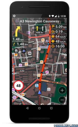
Osmand+ is an open source navigation application with access to a wide variety of global open street map data. All map data (vector or tile maps) can be stored on the phone memory card for offline usage. Osmand also offers offline and online routing functionality including voice guidance.
Osmand+ is the paid application version, by buying it you support the project, fund the development of new features, and receive the latest updates.
Some of the core features:
- Complete offline functionality (store downloaded vector or tile maps in a selectable folder)
- Compact offline vector maps for the whole world available
- Unlimited downloading of country or region maps directly from the app
- Offline Wikipedia feature (download Wikipedia POIs), great for sightseeing
- Overlay of several map layers possible, like GPX or navigation tracks, Points of Interest, favorites, contour lines, public transportation stops, additional maps with customizable transparency
- Offline search for addresses and places (POIs)
- Offline routing for short distances (experimental)
- Car, bicycle, and pedestrian modes with:
- Optional automated day/night view switching
- Optional speed-dependent map zooming
- Optional map alignment according to compass or direction of motion
WHAT'S NEW
- OSM Live fixes
- New magnetic compass widget
- Redesiged Configure screen and Configure map screens
This app has no advertisements
More Info:
Download Instructions:
https://uploadshub.com/cevi5pus483a
Mirrors:
(Closed Filehost) http://uploads.to/vq7w9uywf1yl
https://dailyuploads.net/cr47f3xhgr4j
(Closed Filehost) https://ul.to/y8ekpano
Requirements: 4.0+
Overview: Osmand is opensource navigation application with raster/vector maps
Osmand+ is an open source navigation application with access to a wide variety of global open street map data. All map data (vector or tile maps) can be stored on the phone memory card for offline usage. Osmand also offers offline and online routing functionality including voice guidance.
Osmand+ is the paid application version, by buying it you support the project, fund the development of new features, and receive the latest updates.
Some of the core features:
- Complete offline functionality (store downloaded vector or tile maps in a selectable folder)
- Compact offline vector maps for the whole world available
- Unlimited downloading of country or region maps directly from the app
- Offline Wikipedia feature (download Wikipedia POIs), great for sightseeing
- Overlay of several map layers possible, like GPX or navigation tracks, Points of Interest, favorites, contour lines, public transportation stops, additional maps with customizable transparency
- Offline search for addresses and places (POIs)
- Offline routing for short distances (experimental)
- Car, bicycle, and pedestrian modes with:
- Optional automated day/night view switching
- Optional speed-dependent map zooming
- Optional map alignment according to compass or direction of motion
WHAT'S NEW
- OSM Live fixes
- New magnetic compass widget
- Redesiged Configure screen and Configure map screens
This app has no advertisements
More Info:
Code: Select all
https://play.google.com/store/apps/details?id=net.osmand.plusDownload Instructions:
https://uploadshub.com/cevi5pus483a
Mirrors:
(Closed Filehost) http://uploads.to/vq7w9uywf1yl
https://dailyuploads.net/cr47f3xhgr4j
(Closed Filehost) https://ul.to/y8ekpano
Do not forget to thank and support the developers! If you like the app, buy it!