
Major Android Releaser
- Posts 20278
- WRZ$
68005.70
Gaia GPS: Hiking, Offroad Maps v2020.12 [Subscribed]
Requirements: 5.0 and up
Overview: Plan, navigate, and stay safer in the woods. Topo maps and trails for hikers.
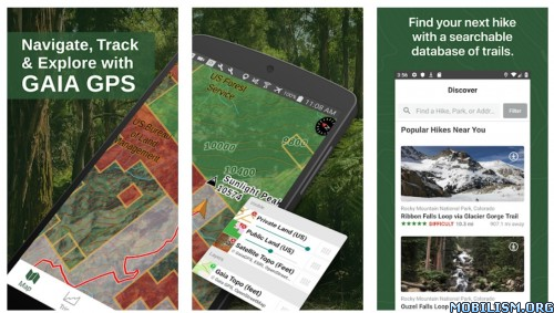
Plan trips and stay safer in the woods, with Gaia GPS.
Join hundreds of thousands of backpackers, hunters, offroaders, mountain bikers, backcountry skiers, firefighters, guides, and other serious outdoor adventurers and professionals that use Gaia GPS for work and play. Hike, hunt, and offroad with the best topo maps and outdoor navigation tools.
►► The Best App for Topo Maps
Gaia GPS has been showcased in Apple's "Your Verse" stories, and covered in countless major publications, from Outside and TrailRunner, to the New York Times and FOX News TappedIn.
The name Gaia (guy-yuh) comes from Greek mythology - she is the Goddess of the Earth, or Mother Nature.
►► Maps
• view easy-to-read, modern maps, with fast and beautiful rendering
• explore historic and classic print maps (NRCan, USGS, USFS, IGN)
• download worldwide topo, road, and satellite maps
• search for hiking trails, parks, natural places, and addresses, and tap features on Gaia Topo to get more info
►► Sync and Back-up
• sync your tracks, photos, maps, and waypoints to all of your devices
• keep your data backed up, effortlessly
• share trip plans, and collaborate on shared folders
►► Map Tools
• record tracks, waypoints, and take geo-tagged photos
• import and export GPX and KML files
• customize coordinates types (Decimal, Degrees/Minutes/Seconds, Degrees - Decimal Minutes, UTM, and MGRS)
►► Membership Levels
Free Level - You can use Gaia GPS for free. You'll be limited to the default map source, and you won't be able to download maps for offline use.
Member Level - As a Member, you can download a worldwide catalog of topo, road, and satellite maps.
Premium Member Level - As a Premium Member, you also get access to these map sources:
• NatGeo Trails Illustrated
• ESRI World Satellite Imagery
• France IGN
• SwissTopo
• US Private Land Ownership (owners and addresses for parcels)
• US Hunting Layers, including GMUs, public land, and fires
• US NeoTreks Topo
• US Motor Vehicle Use Maps (MVUM)
• Hill-shading, contour lines, slope angle, and other overlays
Subscription Unlocked
Arm64-v8a CPU only
Maps works
Cracked by Vennela
What's New:
New
* Dark Mode support!
* Support for “Ask Every Time” location permission
* Tracks are now sorted in “newest on top” order on the map
* Better MGRS coordinate formatting
* Smoother camera panning in location tracking mode
* Confirm cancellation of route and area planning
Fix
* Subscription status not updating properly after signing in
* Crash when syncing very large track files
* Crashes related to reading and writing from device storage
* Stats picker rendering bug in tablet landscape mode
This app has no advertisements
More Info:
Download Instructions:
https://mega4up.org/1ilcwjv7yo9g
Mirror:
https://rg.to/file/cefe398080d489adb9f64f8915825355
(Closed Filehost) http://www.uploadship.com/02bf61b1a26dbbc4
(Closed Filehost) https://ul.to/uazf6tyv
Requirements: 5.0 and up
Overview: Plan, navigate, and stay safer in the woods. Topo maps and trails for hikers.
Plan trips and stay safer in the woods, with Gaia GPS.
Join hundreds of thousands of backpackers, hunters, offroaders, mountain bikers, backcountry skiers, firefighters, guides, and other serious outdoor adventurers and professionals that use Gaia GPS for work and play. Hike, hunt, and offroad with the best topo maps and outdoor navigation tools.
►► The Best App for Topo Maps
Gaia GPS has been showcased in Apple's "Your Verse" stories, and covered in countless major publications, from Outside and TrailRunner, to the New York Times and FOX News TappedIn.
The name Gaia (guy-yuh) comes from Greek mythology - she is the Goddess of the Earth, or Mother Nature.
►► Maps
• view easy-to-read, modern maps, with fast and beautiful rendering
• explore historic and classic print maps (NRCan, USGS, USFS, IGN)
• download worldwide topo, road, and satellite maps
• search for hiking trails, parks, natural places, and addresses, and tap features on Gaia Topo to get more info
►► Sync and Back-up
• sync your tracks, photos, maps, and waypoints to all of your devices
• keep your data backed up, effortlessly
• share trip plans, and collaborate on shared folders
►► Map Tools
• record tracks, waypoints, and take geo-tagged photos
• import and export GPX and KML files
• customize coordinates types (Decimal, Degrees/Minutes/Seconds, Degrees - Decimal Minutes, UTM, and MGRS)
►► Membership Levels
Free Level - You can use Gaia GPS for free. You'll be limited to the default map source, and you won't be able to download maps for offline use.
Member Level - As a Member, you can download a worldwide catalog of topo, road, and satellite maps.
Premium Member Level - As a Premium Member, you also get access to these map sources:
• NatGeo Trails Illustrated
• ESRI World Satellite Imagery
• France IGN
• SwissTopo
• US Private Land Ownership (owners and addresses for parcels)
• US Hunting Layers, including GMUs, public land, and fires
• US NeoTreks Topo
• US Motor Vehicle Use Maps (MVUM)
• Hill-shading, contour lines, slope angle, and other overlays
Subscription Unlocked
Arm64-v8a CPU only
Maps works
Cracked by Vennela
What's New:
New
* Dark Mode support!
* Support for “Ask Every Time” location permission
* Tracks are now sorted in “newest on top” order on the map
* Better MGRS coordinate formatting
* Smoother camera panning in location tracking mode
* Confirm cancellation of route and area planning
Fix
* Subscription status not updating properly after signing in
* Crash when syncing very large track files
* Crashes related to reading and writing from device storage
* Stats picker rendering bug in tablet landscape mode
This app has no advertisements
More Info:
Code: Select all
https://play.google.com/store/apps/details?id=com.trailbehind.android.gaiagps.proDownload Instructions:
https://mega4up.org/1ilcwjv7yo9g
Mirror:
https://rg.to/file/cefe398080d489adb9f64f8915825355
(Closed Filehost) http://www.uploadship.com/02bf61b1a26dbbc4
(Closed Filehost) https://ul.to/uazf6tyv
Tomorrow is a better day.
Laugh and Smile(~ ̄▽ ̄)→))* ̄▽ ̄*)o
Support the developers!
Laugh and Smile(~ ̄▽ ̄)→))* ̄▽ ̄*)o
Support the developers!